
THE recent heatwave has led to several new historic landmarks in and around the Borders being identified from the air.
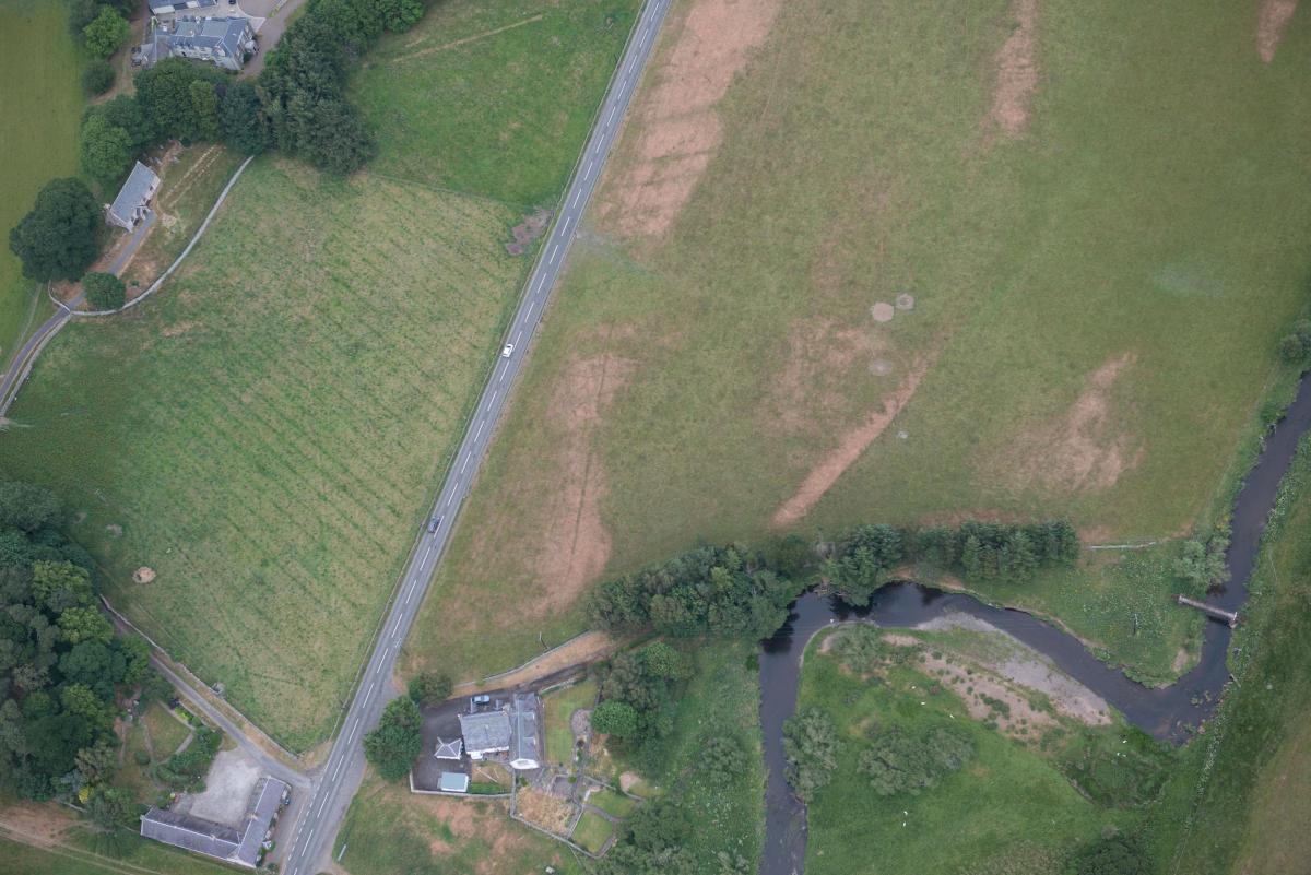
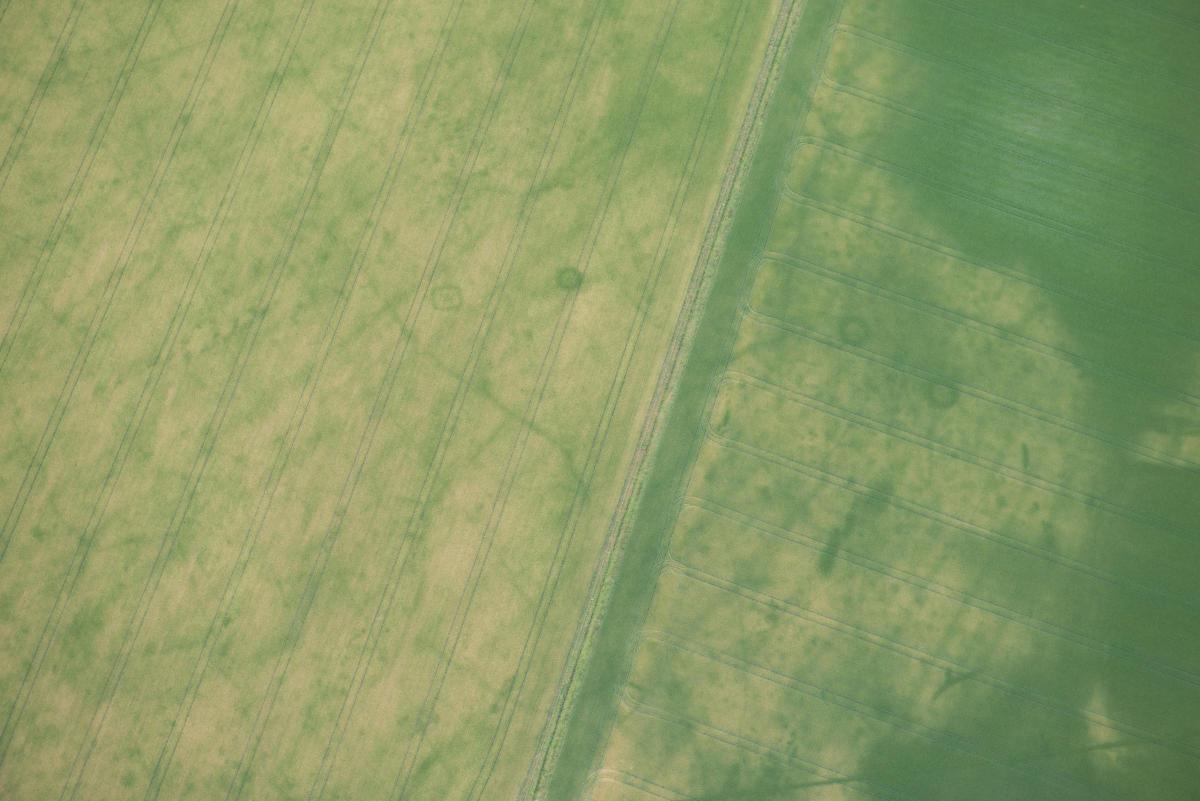
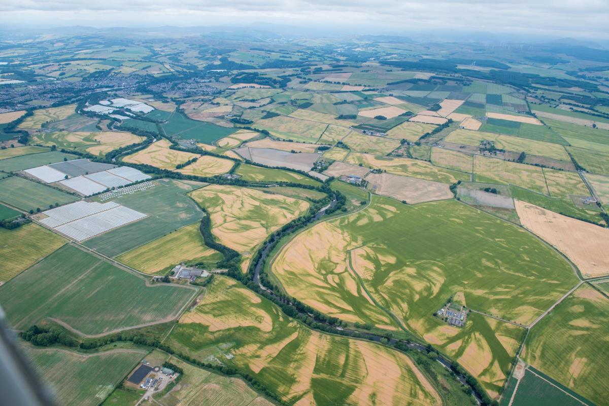
Crop marks showing ancient settlements and Roman fortifications, which were otherwise hidden under the plough soil, are now being documented by Historic Environment Scotland following late June's and early July's drought.
The extensive marks form as the crops respond to dry conditions and have allowed the team to document known sites that have not been visible for many years.
Iron Age burials, Neolithic pits and prehistoric settlements are all marked out in the fields, against a backdrop of long-infilled rivers and streams which tell the story of Scotland’s landscape.
Among the sites identified during the HES aerial survey team are Iron Age souterrains in the Borders – a rare find in this part of Scotland – and a Roman temporary camp within the known complex of sites at Lyne near Peebles.
Dave Cowley, aerial survey project manager at Historic Environment Scotland, told us: “Aerial surveys of Scotland have been carried out since the 1930s, with each year usually adding a little more to the patchwork of our knowledge.
“We depend on dry years to bring out the buried remains in the crops, so we are currently out hunting for new clues from the skies while the good weather lasts.
"The conditions this year are showing us many sites that we knew were there, but may not have seen in recent damp summers, as well as revealing new archaeological sites that add to our ability to see into the past to tell Scotland’s story.”
Historic Environment Scotland’s aerial survey team has discovered and recorded more than 9,000 buried sites since it was formed.


Comments: Our rules
We want our comments to be a lively and valuable part of our community - a place where readers can debate and engage with the most important local issues. The ability to comment on our stories is a privilege, not a right, however, and that privilege may be withdrawn if it is abused or misused.
Please report any comments that break our rules.
Read the rules here